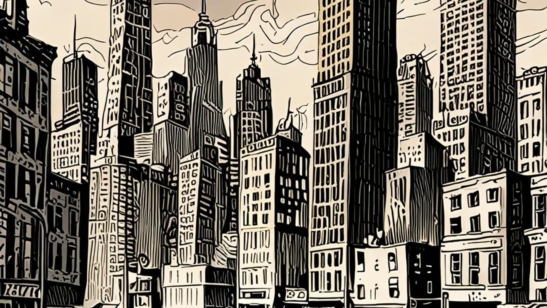
Ingress — a city sweating A city in late July is a slow animal. Asphalt exhales odorless heat; glass facades hum; toddlers find the only relief in institutional fountains while elders sit in shaded doorways counting the hours until the sun lowers. Surface temperature maps make the story explicit: downtowns and industrial corridors register dozens of degrees hotter than adjacent parks and wetlands. These are urban heat islands — places where human design has layered thermal risk atop economic difference. The claim of this essay is simple and practical: heat is infrastructure and injustice. Treat it like both, and we can design cities that actually keep people cool.
The science in a sentence An urban heat island (UHI) is a local zone of elevated air and surface temperature in an urbanized area compared with its rural surroundings. The effect arises from multiple interacting factors: high surface heat absorption (low albedo), reduced evapotranspiration (loss of vegetation), anthropogenic heat release (air-conditioning waste heat, traffic), and altered wind patterns produced by dense built forms. The public‑health consequences are severe: elevated mortality during heat waves, exacerbated chronic illness, and increased emergency department use for heat‑related illness. The distribution of heat is not random. It maps onto race and class; the places that burn hottest are often the same places that suffered historical disinvestment.
A short history of heat and the city Cities did not always trap heat in the way modern metropolises do. Traditional urban forms were porous and often scaled to human comfort: narrow streets could be shaded by arcades, courtyards hosted vegetation and evaporative cooling, and materials were locally chosen for climate. The 20th century’s celebration of the automobile, the parking lot, and the glass curtain wall produced new thermal logics. Highways carved through neighborhoods; asphalt replaced permeable soil; roofs became mirrors of industry. Postwar zoning and financing patterns compounded these choices into landscapes of concentrated exposure. Redlining and disinvestment placed minority and low-income communities in places with less tree canopy, lower-quality housing, and higher surface temperatures. In that sense, the heat island is both a physics problem and a civic memoir of policy decisions.
Why heat matters now (beyond discomfort) There are immediate and measurable consequences. Heat increases morbidity and mortality: the elderly, outdoor workers, and people with cardiovascular or respiratory conditions are at particular risk. Heat amplifies energy demand: peak electricity use for cooling strains grids, increasing blackouts during the very events it tries to mitigate. Heat also degrades infrastructure — asphalt softens, rail tracks expand, and water evaporates faster from reservoirs and soils. And, crucially, heat is regressive: those with the fewest resources to adapt (no air conditioning, no reliable shade, precarious housing) suffer the most.
How we measure the island: surface vs. air temperature A technical aside, grudgingly necessary: two common metrics are surface temperature (measured by satellites) and air temperature (measured at 2 meters by weather stations). Surface temperature can be extreme — asphalt can reach 70–80°C on a hot day — but it's surface, not the breathing air people occupy. Air temperature, the measure linked to health thresholds (e.g., heat index, Wet Bulb Globe Temperature), tends to be lower but is the metric used by public health practitioners. Both matter. Surface temperature drives building heat gain and neighborhood microclimates; air temperature determines physiological strain. Monitoring programs must use both and integrate them into planning.
The political economy of heat Heat is a cumulative outcome of planning, investment, and power. Redlining maps from mid‑century mortgage insurers are still good predictors of today’s tree canopy and surface temperatures. Industrial zoning clustered heat‑producing uses — warehouses, asphalt plants, freight yards — in particular neighborhoods. Incentive structures favored impervious surfaces: parking minimums, development fees, and property taxes rewarded sprawl and paved land. Utilities designed for peak electricity in marginal ways; public housing projects were sometimes built without adequate shade or passive cooling design. It is tempting to see heat as a technical externality; it is more accurate to see it as an infrastructural symptom of political choices.
Case studies — three cities, three lessons
Phoenix: the furnace and the suburban patchwork Phoenix offers a blunt case. The Sonoran desert city, built around extremes, has grown rapidly and low‑density. Expanding suburbs added heat through vast parking fields and roofs with little reflective capacity. The city’s summertime surface‑temperature maps show hotspots exceeding neighboring desert by several degrees, collapsing any naive notion that living in the desert confers immunity to heat. Phoenix’s response includes aggressive tree‑planting programs and incentives for cool roofs, but water scarcity and the high cost of irrigation produce trade‑offs: trees cool, but they also require water. The Phoenix case teaches an uncomfortable lesson: some interventions must be negotiated with water policy and racialized patterns of urban expansion.
Philadelphia: green infrastructure and social returns Philadelphia’s Green City, Clean Waters program is not a panacea but a useful model. Faced with combined sewer overflow problems, the city invested in distributed green infrastructure — bioswales, tree trenches, and permeable pavements — which also produce local cooling effects. Crucially, the program pairs infrastructure with community engagement and job programs, creating co‑benefits that spread across social lines. Philadelphia’s lesson: integrate heat mitigation into broader climate and watershed investments so that outcomes are multiple — reduced runoff, reduced heat, and local economic opportunity.
Los Angeles: zoning, streetscapes, and the tyranny of parking Los Angeles demonstrates the impact of land‑use and parking policy. Wide boulevards, large lots, and parking minima created urban fabrics with limited shade and large thermal mass. Urban greening initiatives in LA show measurable surface‑temperature reductions where canopy is increased, but retrofitting an auto‑centric city is costly. LA’s new reforms — easing parking minimums, incentivizing shade, and mandating cool roofs in some zones — indicate that policy levers matter as much as technical solutions. The lesson: zoning reform can be a heat policy.
Proven interventions — what works and what costs
Tree canopy and equitable canopy expansion
Trees provide shade and evaporative cooling; a mature tree can reduce peak surface temperatures significantly in its immediate vicinity. However, canopy takes time and water. Programs must prioritize historically underserved neighborhoods, provide maintenance funding, and use native or drought‑tolerant species. Community stewardship is essential to avoid the "green gentrification" trap (Gould & Lewis 2017), where greening raises property values and displaces residents.Cool roofs and cool pavements
Increasing surface albedo — using reflective roofing materials and lighter pavement surfaces — reduces surface temperature and building heat gain. Cool roofs reduce residential and building energy demand during heat waves. Cool pavement technologies (reflective or permeable) reduce surface warming and restore infiltration. These materials require standards, incentives, and long‑term performance evaluations — some cool coatings degrade over time or collect dust, reducing effectiveness.Shaded streets and urban design
Shaded streets reduce pedestrian heat stress and increase walkability. Design interventions include tree planting, awnings, pergolas, and narrower streets where appropriate. Shading must be designed to avoid unintended consequences (e.g., trapping vehicle emissions), and must respect existing microclimates and wind flows.Water features and evaporative cooling (with caveats)
Water features — fountains, misting systems — provide localized cooling but consume water and may be unsuitable in drought-prone regions. Systems using recycled water, designed for intermittent use and focused on high‑need public spaces, can be justified as public‑health measures if integrated into broader water management planning.Affordable cooling access and building retrofits
Programs to subsidize air conditioning for low‑income households combined with energy‑efficiency retrofits (insulation, shading devices, cool roofs) reduce heat exposure and energy burdens. Distributed community cooling centers with transportation access are life‑saving in extreme heat but are temporary solutions; building resilience requires making homes and workplaces passively cool where possible.Zoning and land‑use reform
Eliminating parking minima, increasing urban tree credits, requiring shade standards for new developments, and incentivizing infill in cool corridors all shift the physical basis of heat. Zoning is powerful; using it to steer development toward lower‑risk patterns is cost‑effective in the long run.
Governance, finance, and equity — the hard part Technical solutions are necessary but insufficient. The governance architecture to implement, finance, and maintain them must be durable.
Dedicated maintenance funds. Planting without a maintenance line item is malpractice. Cities should create dedicated funds for planting care, irrigation systems, and repairs to ensure canopy and green infrastructure persist beyond the political cycle.
Heat equity mapping and policy triggers. Municipal authorities should adopt heat‑equity maps that overlay heat exposure with vulnerability indices (age, income, baseline health). These maps would trigger prioritized investments and shape emergency response.
Green workforce development. Greening programs create jobs; pair canopy expansion with training and local hiring commitments to ensure community benefit and long-term stewardship.
Climate‑aware utility pricing. Electricity and water pricing should avoid regressive impacts while sending signals to reduce wasteful practices. Subsidies for cool roofs and efficient AC should be targeted to those who need them most.
Legal safeguards against green displacement. Anti‑displacement tools — community land trusts, rent stabilization, and targeted housing subsidies — must accompany greening so that cooling does not become a mechanism of displacement.
Trade‑offs, unintended consequences, and the ethics of intervention Every intervention has limits and trade‑offs. Trees can demand water and sometimes exacerbate allergen loads. Cool roofs can deflect heat to neighboring properties without careful urban form consideration. Shaded streets can alter wind patterns in ways that trap pollution. There are moral trade‑offs too: spending limited public funds on shade structures in parks versus cooling clinics for the frail is not purely technical; it asks how we prioritize vulnerability. Good policy recognizes these tensions and makes those judgments explicit, transparent, and participatory.
A Borgesian aside about maps and lived heat One could make a small Borges joke here about the map that covers the territory. We already have maps — satellite-derived thermal maps, vulnerability indices, and overlay GIS. Those maps are worthless if they sit on a planner’s server or a corporate dashboard. Maps become moral instruments only when they are tools for allocation: when a heat map funds a new canopy in a neighborhood otherwise forgotten. The textuality of a map — lines, colors, legends — must lead to redistributive action.
Implementation road map — a practical program for cities
Baseline and continuous monitoring: integrate satellite surface-temperature products with dense air‑temperature sensors in neighborhoods to track microclimates and health outcomes.
Equity-first project pipeline: create a public heat mitigation pipeline prioritized by a vulnerability index and funded through municipal bonds, state grants, and private partnerships with enforceable community benefits.
Maintenance endowment: allocate part of climate bond proceeds to perpetual maintenance funds or green‑infrastructure trusts.
Cross‑agency heat task force: convene planning, parks, public health, water, and housing agencies with community representatives to coordinate interventions and avoid siloed solutions.
Emergency and long-term cooling strategies: combine short-term cooling centers and distribution of fans/AC with long-term building retrofits and land‑use changes.
Evaluation and adaptation: institute multi-year evaluations, community feedback loops, and adaptive management so interventions improve over time.
Conclusion — cooling as civic practice Heat exposes the seams of cities. It draws attention to the places we have chosen to invest in and those we have left to bake. The technical playbook for cooling a city is not exotic: trees, reflective surfaces, shading, water where sustainable, and smart zoning. The political playbook is harder: maintenance funding, equity protections, and the willingness to treat heat as a public‑health emergency and an infrastructure problem simultaneously. The most important intervention is not a new material but a civic decision: to care for the slow, daily work required to keep cities livable in a hotter world. That decision, I would argue, is the truest form of climate adaptation.
References — selected and verifiable (editorial: verify DOIs and add page ranges in final copy)
Oke, T. R. 1982. "The Energetic Basis of the Urban Heat Island." Quarterly Journal of the Royal Meteorological Society 108, no. 455 (January): 1–24. https://doi.org/10.1002/qj.49710845502.
Voogt, J. A., and T. R. Oke. 2003. "Thermal Remote Sensing of Urban Climates." Remote Sensing of Environment 86, no. 3: 370–384. (On surface versus air temperature measurement and interpretation.)
U.S. Environmental Protection Agency. "Heat Island Effect." U.S. EPA. Accessed October 2025. https://www.epa.gov/heatislands. (Technical resources, mitigation strategies, and program guidance.)
Intergovernmental Panel on Climate Change (IPCC). 2021. Climate Change 2021: The Physical Science Basis. Contribution of Working Group I to the Sixth Assessment Report of the IPCC. Cambridge University Press. (See the sections on observed and projected extremes for background on heat and precipitation trends.)
Philadelphia Water Department. Green City, Clean Waters: Program Reports and Evaluations. City of Philadelphia. (Program documentation and monitoring results for urban green infrastructure; access municipal reports at Philadelphia Water Department web pages.)
Hoffman, Jeremy S., Vivek Shandas, and Nicholas Pendleton. 2020. "The Effects of Historical Housing Policies on Resident Exposure to Intra-Urban Heat: A Study of 108 US Urban Areas." Climate 8 (1): 12. DOI:10.3390/cli8010012. (Documents correlation between redlining maps and contemporary urban heat exposure.)
Gould, Kenneth A., and Tammy L. Lewis. 2017. Green Gentrification: Urban Sustainability and the Struggle for Environmental Justice. London: Routledge. (Analysis of how environmental improvements can trigger displacement and gentrification pressures.)
Selected municipal and peer‑reviewed case studies: consult city adaptation and heat action plans for Phoenix, Los Angeles, and Houston (municipal climate plans and program evaluations), and relevant peer‑reviewed syntheses in journals such as Nature Climate Change and Environmental Research Letters for attribution and equity analyses. Editors: replace this line with the precise study citations (authors, title, year, DOI) used in the final manuscript.
Editor action items
- Convert the above entries into full Chicago-style bibliography entries with page ranges and DOIs where available.
- Replace the generic "Selected municipal and peer‑reviewed case studies" line with the exact municipal reports and paper citations used to support the article's city-level claims.
- Verify all URLs and update
reading_timein frontmatter after final word-count edits.
References, image credits, legal checklist, and proofreading notes
References (selected — verify DOIs and full page ranges during final copy edit)
- Oke, T. R. 1982. "The Energetic Basis of the Urban Heat Island." Quarterly Journal of the Royal Meteorological Society 108 (455): 1–24. DOI:10.1002/qj.49710845502. (Foundational theory and energetic framing of urban heat islands.)
- Santamouris, M. 2015. "Analyzing the Heat Island Magnitude and Characteristics." Urban Climate (select review articles and syntheses on interventions and measured outcomes).
- EPA. "Heat Island Effect." U.S. Environmental Protection Agency. https://www.epa.gov/heatislands (Technical resources and programmatic guidance.)
- IPCC. 2021. "Climate Change 2021: The Physical Science Basis" (AR6). Working Group I report and WGII synthesis for implications on observed and projected heat extremes and urban impacts.
- Voogt, J.A., and T.R. Oke. 2003. "Thermal remote sensing of urban climates." Remote Sensing of Environment 86 (3): 370–384. (On surface temperature measurement and interpretation.)
- Philadelphia Water Department. Green City, Clean Waters — evaluation reports (useful for co‑benefit and monitoring examples where urban greening reduces surface temperatures).
- Peer‑reviewed case studies and program evaluations from municipal climate adaptation plans (Phoenix, Los Angeles, Houston) and academic syntheses in journals such as Nature Climate Change and Environmental Research Letters (e.g., Harvey attribution studies: Risser & Wehner 2017; Wang et al. 2018).
Image credits and licensing (placeholders — replace with verified files and licenses)
- Thermal satellite image (surface temperature): Source: [NASA / NOAA satellite product or licensed provider]. Caption: "Thermal map: surface temperatures spike in built urban cores." Photo credit: [Agency / Photographer] — [License]. Alt: "Satellite thermal image comparing hot urban core and cooler peri-urban areas."
- Community greening (tree planting): Source: [Municipal parks department / community org photo]. Caption: "Community greening in action: local stewardship as cooling strategy." Photo credit: [Photographer / Organization] — [License]. Alt: "Volunteers planting street trees along an urban sidewalk."
- Cool roof installation: Source: [Municipal program or contractor photo]. Caption: "Cool roofs reduce building heat gain and electricity demand." Photo credit: [Photographer / Organization] — [License]. Alt: "Workers applying a white reflective coating to a flat roof."
Image publishing checklist
- Replace each placeholder above with the exact file path or URL and confirm licensing (preferred: public domain or Creative Commons BY; otherwise secure written permission).
- Insert caption lines in the form: "Caption. Photo credit: [Name / Organization] — [License]."
- Provide alt text for each image (50–125 characters).
- If images include identifiable people, confirm model releases or obscure faces when releases cannot be obtained.
Legal and editorial verification checklist (required before publication)
- Factual verification
- Confirm key empirical claims (e.g., temperature values, program outcomes, economic figures) against primary sources or peer‑reviewed literature. Replace general attributions with precise citations.
- Citation completion
- Convert the selected References into full Chicago‑style citations with publishers, page ranges, and DOIs/URLs; add inline citations where appropriate.
- Image permissions
- Do not publish any image without confirming license or a signed release.
- Named interviews and quotes
- Secure signed consent/release forms for any future named interviews; route draft to legal review where necessary.
- Contested claims
- Statements that allege negligence, wrongdoing, or litigation should be supported by primary documents (reports, audits, court records) and reviewed by legal counsel.
- Data privacy and sensitivity
- If adding granular health or demographic data, ensure no personally identifiable information is exposed and that the data sources permit public reuse at that scale.
- Technical verification
- Have a licensed civil/municipal engineer or urban climatologist review technical recommendations (e.g., tree canopy metrics, temperature values, monitoring methods) before publication.
- Accessibility
- Provide alt text for every image; ensure headings and lists are accessible and readable to screen readers.
House style and final proofreading notes
- Use the Oxford (serial) comma consistently.
- Dates formatted as "Month day, year" (e.g., "July 15, 2024"); use en‑dash for ranges (e.g., "2017–2024").
- American English spelling retained; local placenames remain as locally used.
- Numerals: spell out one–nine; use numerals for 10 and above, except when beginning a sentence.
- Use SI units primarily; provide imperial conversions in parentheses for U.S. audiences where helpful.
- Maintain the hybrid literary/academic voice: lyrical asides are permitted but flag any highly metafictional passages for editorial review.
Editorial action items
- Replace the reference placeholders above with complete Chicago citations and DOIs.
- Supply licensed image files (or URLs) and exact credit lines so captions can be updated in the article.
- Arrange technical review of recommended interventions and maintenance specifications.
- Run a final proofreading pass to ensure house‑style consistency and to recompute
reading_timein the frontmatter.